|
|
Post by Kaez on Nov 4, 2010 19:12:16 GMT -5
... yes, I know. MOVING ON. Step #1 A: Outlining. Typically we'd be dealing with drawing up your own, unique outline: the shores of all of your land mass. In this case, though, I'm basing it off of an older map of mine -- but I'm making some tweaks. I highlight them here.  Step #1 B: What step #1 normally means, your outline.  Step #2: Mountains! The most definitive feature of your landscape is mountains, so they're the first thing you need to figure out. Red is where small mountains will go, red-blue is where major ranges will go. 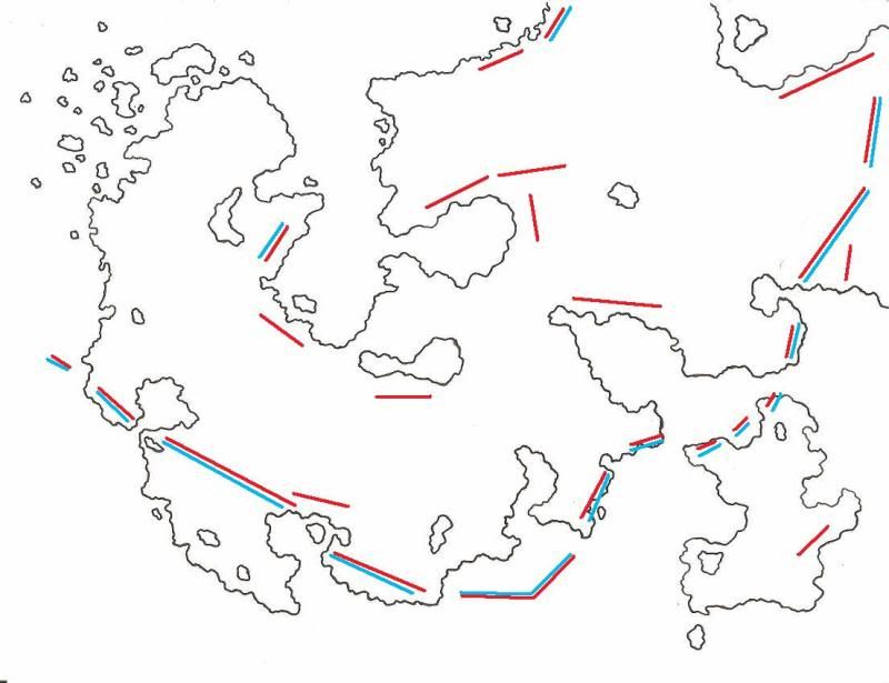 Step #3: Drawing in the mountains (and, if you're making a colored map, the beginning of coloring). I used a very dark blue here -- much darker than I usually do and, until I color the rest, I can't be sure whether I like it or not ( I think I probably don't ). But this map was largely for the sake of getting adjusted to mapmaking again, so consider it an experiment.  The rest to come :] |
|
|
|
Post by ASGetty ((Zovo)) on Nov 4, 2010 19:43:14 GMT -5
Curious. . .
How come you've so many coastal ranges? Do you consider things like geology and plate techtonics when deciding where your mountains will be placed?
|
|
|
|
Post by Kaez on Nov 4, 2010 19:59:50 GMT -5
Curious. . . How come you've so many coastal ranges? Do you consider things like geology and plate techtonics when deciding where your mountains will be placed? Quite a lot, actually -- and that's exactly why I have so many coastal ranges in this area. If you follow the mountains on the far right down and across, you'll see it's actually a single range that goes across. This entire area is defined by the upper plate's collision with the ocean plate on the bottom of the picture. Basically, imagine if just about everything west of the Rockies dropped right off into the water, then turn that 90 degrees counter-clockwise. It's a more jagged, rocky, Western Europe we're dealing with here. Once I get the full map up, you'll see that the ranges aren't -all- coastal. Like I said, we're basically only dealing with a single mountain range here: just a really big one. |
|
|
|
Post by Kaez on Nov 5, 2010 15:30:39 GMT -5
Step #4: Goodness look at those forests. This step requires really defining where you want various features and basically shape the entire landscape -- you don't load an area up with forests if you expect it to be a steppe.  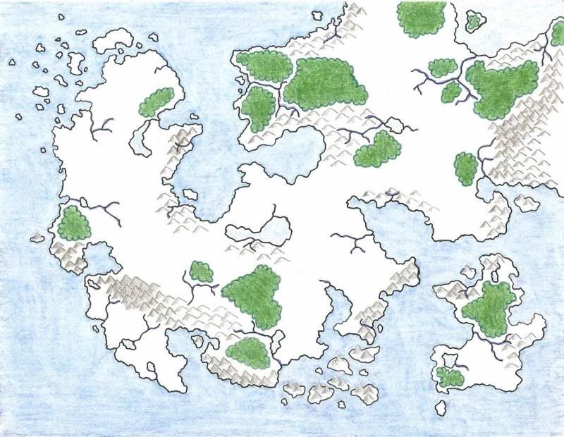 |
|
|
|
Post by WJChesek ((Evern)) on Nov 5, 2010 15:39:46 GMT -5
It's clear to me that I do need to work on my cartography skills. I envy you, Kaez.
At least, insofar as I need to make sure that the geological features makes sense.
|
|
|
|
Post by Kaez on Nov 5, 2010 15:58:09 GMT -5
It's clear to me that I do need to work on my cartography skills. I envy you, Kaez. At least, insofar as I need to make sure that the geological features makes sense. It's fun to make maps where you just put in all the cool shit you want to wherever you want to. But if you can find a way to make a working geography, a place where mountains have rainshadows and where ranges add up and where swamps lie in geological lowlands... it's much more rewarding. |
|
|
|
Post by WJChesek ((Evern)) on Nov 5, 2010 16:19:44 GMT -5
It's clear to me that I do need to work on my cartography skills. I envy you, Kaez. At least, insofar as I need to make sure that the geological features makes sense. It's fun to make maps where you just put in all the cool shit you want to wherever you want to. But if you can find a way to make a working geography, a place where mountains have rainshadows and where ranges add up and where swamps lie in geological lowlands... it's much more rewarding. Yeah, that's the idea. Luckily, where I am in BM lets me change the map however I want. And I do have a very basic desert-mountain relationship with rain shadows and what not. What I don't have is any clue where things like swamps and others go in relation to these. I've forests just wherever I wanted, and the mountains tend to make up the spines of the continent instead of the proper tectonic plates. However, on my larger world maps, I do tend to have a kinda "former pangea" thing going on, where all the islands and continents seem to fit together in a giant puzzle. It's just that the rest doesn't fit. |
|
|
|
Post by Kaez on Nov 5, 2010 16:20:19 GMT -5
Step 7. And that's how you turn this: 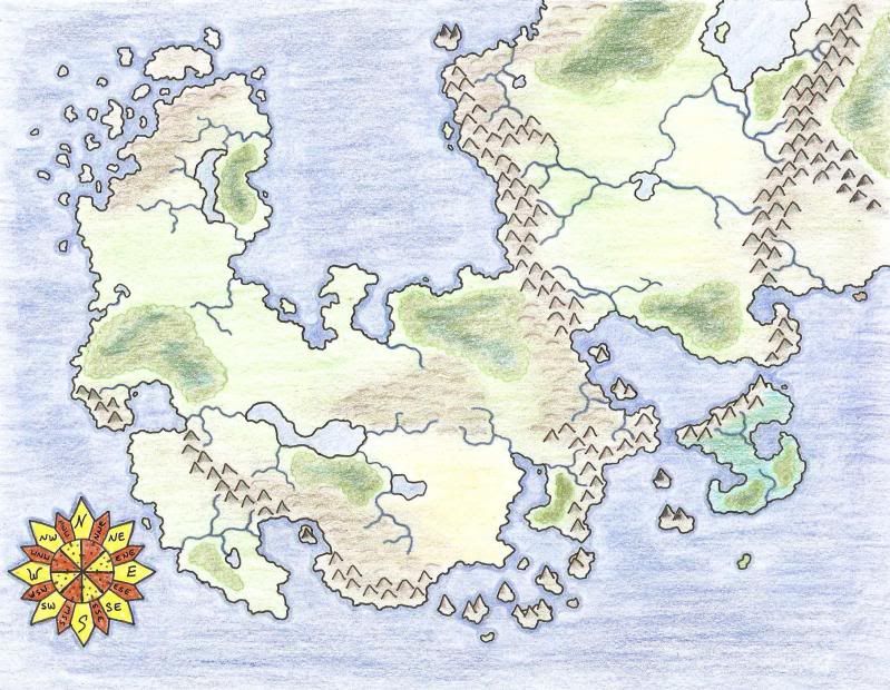 Into this: 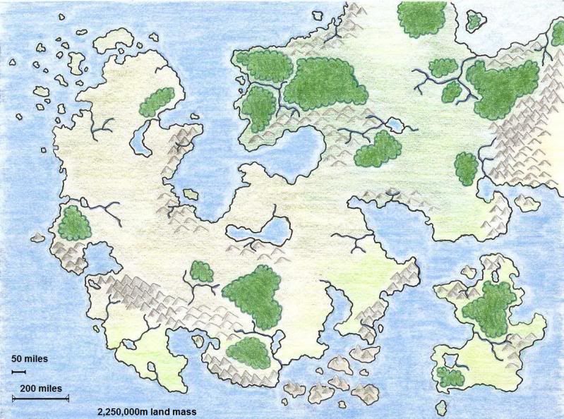 |
|
|
|
Post by Kaez on Nov 5, 2010 17:53:05 GMT -5
Here's the -full map- of the world that this land is set in. 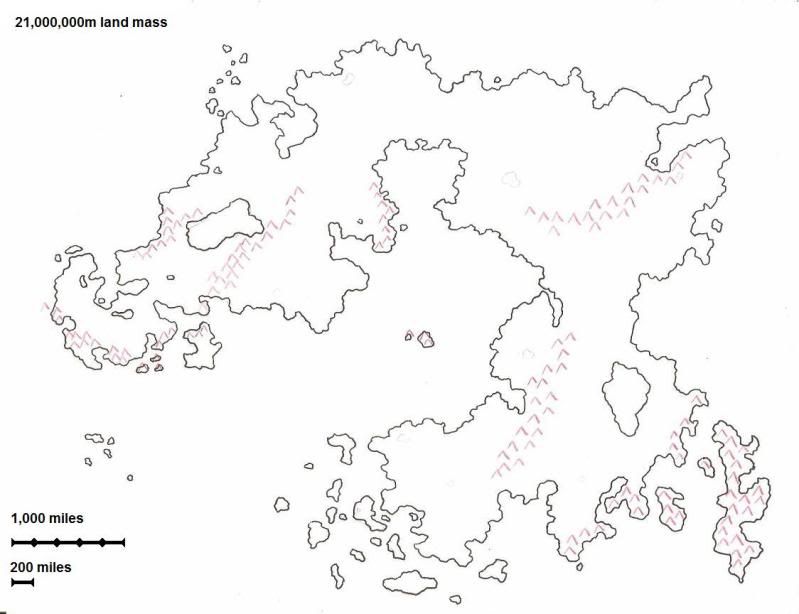 And the basic tectonics that make it up. 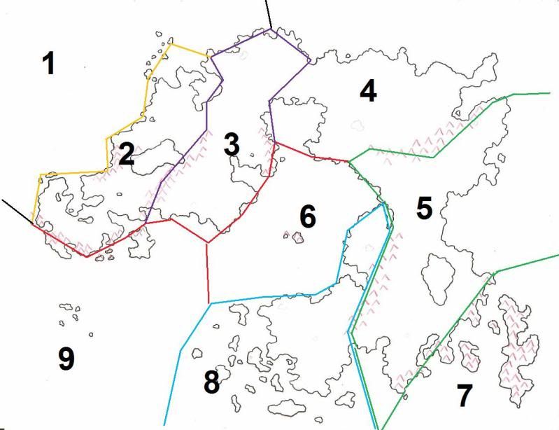 |
|
|
|
Post by Kaez on Nov 5, 2010 18:55:04 GMT -5
Added in scales and sizes.
The smaller continent is about 2,250,000 square miles (a bit smaller than Australia).
The full world is 21,000,000 square miles (slightly larger than the whole of Asia).
|
|